BTC USD 83,384.0 Gold USD 4,117.25
Time now: Jun 1, 12:00 AM

Gunung berapi Sinabung meletus lagi

Mount Sinabung raised to alert level after 3,500-meter ash eruption​

1000532019.jpg

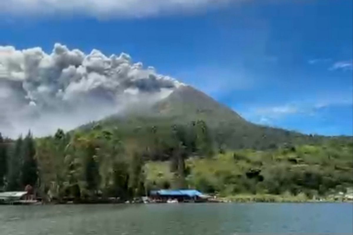
Mount Sinabung in Karo District, North Sumatra, has been upgraded from Level II (Caution) to Level III (Alert) following increased volcanic activity and an eruption that produced an ash column approximately 3,500 meters high. ANTARA/Ade Friadi

Karo (ANTARA) - Mount Sinabung in North Sumatra has been upgraded from Level II (Caution) to Level III (Alert) following increased volcanic activity and an eruption that produced an ash column reaching approximately 3,500 meters above the summit.

The Geological Agency raised the alert status in Karo District on Monday, effective at 12:30 p.m. local time, following an eruption at 10:17 a.m. local time.

The eruption's ash column reached approximately 3,500 meters above the summit, or roughly 5,960 meters above sea level.

Following the elevation to Level III (Alert), residents, visitors, and tourists are advised against engaging in any activities within the villages that have been relocated.

Residents are also prohibited from conducting activities within a three-kilometer radius of Mount Sinabung's summit and within a six-kilometer sectoral radius in the south-southeast sector.

In addition to the threat of eruptions, people living near rivers originating from Mount Sinabung are urged to remain vigilant regarding the potential for lahar floods.

The Geological Agency advises the public to remain calm and not be swayed by unverified information or rumors concerning Mount Sinabung's activity.

The public is urged to follow directives issued by the North Sumatra Provincial Disaster Management Agency (BPBD) and the Karo District BPBD.

Local government authorities, including the North Sumatra and Karo District BPBDs, are also requested to maintain active coordination with the Mount Sinabung Volcano Observation Post in Ndokum Siroga Village, Simpang Empat Sub-district, Karo District.

Updates on Mount Sinabung's activity can be monitored via the MAGMA Indonesia application, as well as through the official channels of the Center for Volcanology and Geological Hazard Mitigation (PVMBG) and the Geological Agency.


Geological Agency warns of potential larger Sinabung eruption​

1000532019.jpg

The status of Mount Sinabung in Karo District, North Sumatra, has been raised from Level II to Level III (Alert) following increased volcanic activity and an eruption that emitted an ash column approximately 3,500 meters high. ANTARA/AdeFriadi

Jakarta (ANTARA) - The Geological Agency of the Ministry of Energy and Mineral Resources (ESDM) predicted a larger eruption following the initial eruption of Mount Sinabung in Karo District, North Sumatra, on Monday.

"This is an initial eruption and does not rule out the possibility of a larger eruption," Head of the Geological Agency Lana Saria informed on Monday.

She said Mount Sinabung’s volcanic activity would remain under close monitoring, with its status reassessed regularly and whenever significant changes are detected to guide preparedness efforts.

The agency previously detected Mount Sinabung erupting on Monday with an eruption column reaching approximately 3,500 meters above the summit, or approximately 5,960 meters above sea level.

A thick, black ash column was observed leaning toward the east and southeast. The eruption was recorded on a seismogram with a maximum amplitude of 120 millimeters.

Increased volcanic activity had been detected before the eruption.

The Geological Agency recorded 85 volcanic earthquakes, one gust earthquake, and one harmonic tremor before the eruption at 10:17 a.m. local time.

Based on the results of visual and instrumental monitoring, the agency also raised Mount Sinabung's activity level from Level II to Level III (Alert) effective August 31, 2026, at 12:30 p.m. The volcano had previously been at Level II since May 17, 2023.

At Level III, residents and visitors must refrain from activities in relocated villages and within a three-kilometer radius of the summit of Mount Sinabung and a six-kilometer sectoral radius to the south-southeast.

Residents living near rivers originating from Mount Sinabung are also urged to remain alert to potential lava flows.

Monitoring from August 1-30, 2026, showed Mount Sinabung emitting white and gray smoke from its main crater, with a thin to thick intensity, at a height of approximately 50-1,000 meters from the summit.

Furthermore, vegetation on the eastern slopes was observed to be yellowing and drying.

The Geological Agency urged the public to remain calm, increase vigilance, and follow the directions of the North Sumatra Provincial Disaster Mitigation Agency (BPBD) and the Karo District Disaster Mitigation Agency (BPBD).

The local government was also urged to maintain coordination with the Sinabung Volcano Observation Post in Ndokum Siroga Village. Updates on volcanic activity are available through the Geological Agency’s official PVMBG app and channels.


Indonesia's Mount Sinabung alert raised, faster evacuations ordered​

1001073872.jpg

North Sumatra Governor Bobby Nasution has ordered faster evacuations from danger zones around Mount Sinabung after authorities raised the volcano’s alert status from Level II (Watch) to Level III (Alert). ANTARA/HO-Diskominfo Sumut

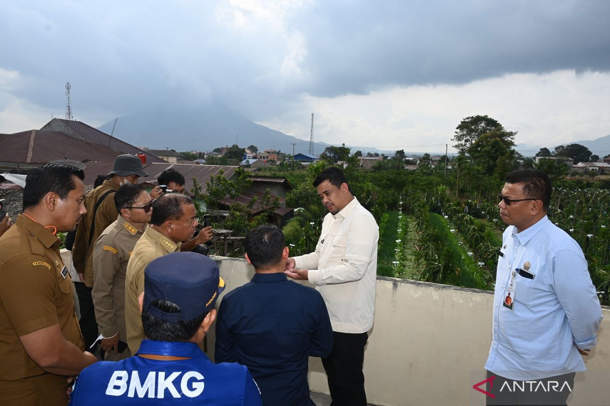
Medan, N Sumatra (ANTARA) - North Sumatra Governor Bobby Nasution has ordered faster evacuations from danger zones around Mount Sinabung after authorities raised the volcano’s alert status from Level II (Watch) to Level III (Alert).

Bobby said protecting lives was the top priority and urged local authorities and regional leaders to ensure residents’ needs were met.

“Protecting lives must come first,” he said on Tuesday after chairing an emergency coordination meeting at the Sinabung Volcano Observation Post in Karo District.

Bobby ordered comprehensive and firm evacuation measures, particularly in red zones, to prepare for a possible increase in Sinabung’s volcanic activity.

The Geological Agency’s Volcanology and Geological Hazard Mitigation Center (PVMBG) recommended a three-kilometer danger radius and a six-kilometer sectoral zone southeast of Sinabung.

“Intensify outreach to residents in danger zones. If activity increases, issue firm evacuation orders, even if necessary, for their safety,” Bobby said.

Bobby also ordered authorities to quickly maximize support facilities at evacuation centers.

The North Sumatra provincial government will provide logistics, evacuation equipment, and operational support for personnel responding to Sinabung’s eruption.

“Do not provide inadequate facilities. Use the budget properly and ensure evacuation centers are decent and comfortable,” Bobby said.

Armen Putra, head of the Sinabung Volcano Observation Post, said visual and seismic monitoring indicated that magma was moving toward the surface, potentially destabilizing an older lava dome.

“A hotspot was detected last night, indicating lava had reached the surface. Rising internal pressure could break the old lava dome and trigger a major eruption,” Armen said.

Karo District Head Antonius Ginting said the danger zone had expanded to six kilometers, with evacuations focused on Kuta Tengah Village because it is surrounded by red zones.

“We plan to evacuate 140 families, or about 684 people, from Kuta Tengah. More than 260 people had been moved to shelters by Tuesday afternoon,” he said.

To assist residents who still work in their fields during the day, the Karo administration, military, and police deployed shuttle vehicles to support evacuations.

Authorities also prepared vehicles and personnel to evacuate residents of Payung Village, outside the main evacuation zone, if Sinabung’s activity intensifies.

The local government, military, police, and volunteers deployed 843 personnel under the command of the Karo Military District Command 0205 and Karo Police.

Other measures included suspending classes at several schools within the six-kilometer affected zone, including Guru Kinayan Elementary School, Payung Elementary School, Ndeskati Elementary School, and Atap Payung 1 Junior High School.


Sinabung Eruption: Karo district ensures basic needs for evacuees​

1000534070.jpg

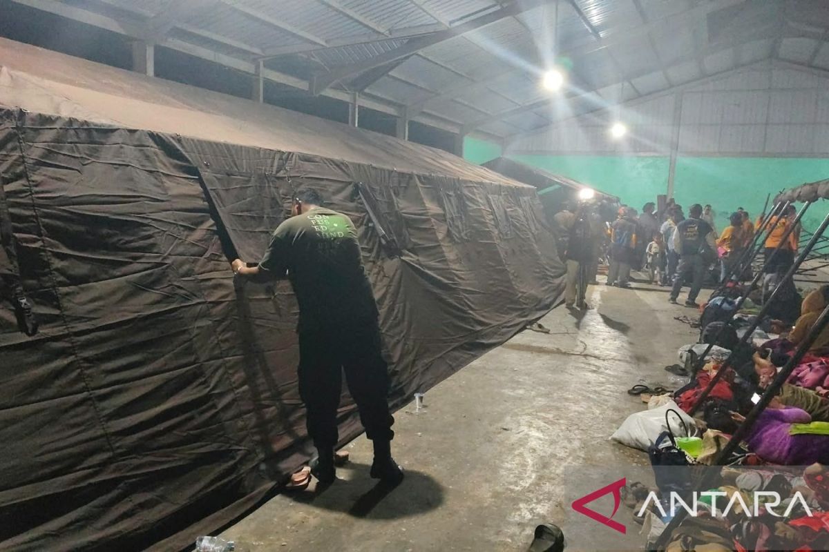
The Karo district government in North Sumatra is ensuring evacuees from Mount Sinabung’s eruption have food, clean water, adequate shelter and other essential supplies. ANTARA/AdeFriadi

Karo, N Sumatra (ANTARA) - The Karo district government in North Sumatra is ensuring that evacuees from Mount Sinabung’s eruption have access to food, clean water, adequate shelter, and other essential supplies.

“We are here not merely to inspect, but to share what our fellow residents are experiencing. This shows that the government is present during difficult times,” Karo District Head Antonius Ginting said at Sukatepu Village in Namanteran Subdistrict on Tuesday night.

The Karo administration and the regional leadership coordination forum, or Forkopimda, are committed to providing services and assistance throughout the emergency response period.

Antonius said authorities would continue monitoring evacuees and meeting their needs until conditions around Mount Sinabung stabilize.

“We will remain present and support residents. Their safety is our top priority,” he said.

Authorities also urged residents to follow officials’ instructions and avoid returning to areas within danger zones until authorities declare them safe.

Antonius, Karo Deputy District Head Komando Tarigan, and members of the Karo Regional Leadership Coordination Forum (Forkopimda) also shared dinner with residents affected by the eruption at Losd Pulunipe in Sukatepu Village, Namanteran Subdistrict.

The gathering underscored the local government’s commitment to supporting affected residents while helping ensure their basic needs were met at the evacuation site.


Mount Sinabung eruption cancels 21 flights at Kualanamu Airport​

1001073803.jpg

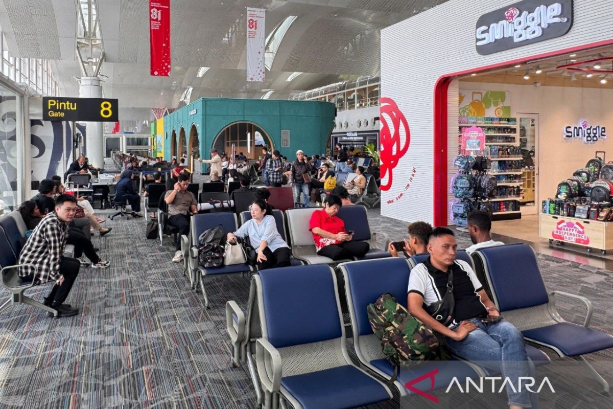
PT Angkasa Pura Aviasi, operator of Kualanamu International Airport, is prioritizing flight safety as operations are adjusted following Mount Sinabung’s eruption in North Sumatra. ANTARA/HO-PT Angkasa Pura Aviasi

Medan, N Sumatra (ANTARA) - PT Angkasa Pura Aviasi, the operator of Kualanamu International Airport, is prioritizing flight safety as operations are adjusted following the eruption of Mount Sinabung in North Sumatra.

“Mount Sinabung’s eruption on Monday, August 31, affected flights to and from Kualanamu,” acting Director of Operations and Services Dedy Sri Cahyono said Tuesday.

Volcanic ash from Sinabung has prompted airlines to adjust their operations, including through flight delays, schedule changes, and cancellations on domestic and international routes.

“Preliminary data show that 21 flights to and from Kualanamu have been canceled, while others face delays and schedule adjustments,” Dedy said.

The number of affected flights remains dynamic, depending on the spread of volcanic ash and individual airlines’ operational decisions.

AirNav Indonesia issued Notice to Airmen A3250/26, announcing the temporary closure of Kualanamu as a precautionary measure to protect flight safety.

“Kualanamu was temporarily closed from 10:50 a.m. to 12:45 p.m. Tuesday because of Sinabung’s volcanic ash,” Dedy said.

PT Angkasa Pura Aviasi and other stakeholders are closely coordinating and monitoring conditions to determine further operational measures. The measures are intended to ensure that all flight operations continue to prioritize safety and security.

“We urge passengers traveling to or from Kualanamu to regularly check their flight status through their airlines’ official information channels,” Dedy said.


Mount Sinabung eruption: 615 residents evacuated in North Sumatra​

IMG-20260902-WA0003.jpg

Residents of Kuta Tengah Village, Simpang Empat Subdistrict, Karo District, North Sumatra, evacuate to an emergency response post in Sukatepu Village, Naman Teran Subdistrict, following increased volcanic activity at Mount Sinabung on Tuesday (September 1, 2026). (ANTARA/HO-Karo BPBD)

Jakarta (ANTARA) - Indonesia’s disaster agency said 615 residents had been evacuated to shelters as authorities sought to protect communities in North Sumatra’s Karo District from Mount Sinabung’s eruption.

The National Disaster Mitigation Agency (BNPB)’s Acting Head of Disaster Data, Information, and Communications, Berton SP Panjaitan, said here Wednesday that the evacuation followed heightened volcanic activity after a major eruption earlier this week.

“Preliminary data show that about 211 families, or 615 residents of Kuta Tengah Village, are now at the emergency response shelter in Sukatepu Village,” he said.

Berton said evacuations prioritized residents living near danger zones, including Kuta Tengah and Payung Villages, which are exposed to potential eruptions from Sinabung.

“Residents of Payung Village remain at home but are on full alert under the monitoring of the joint response team,” he said.

BNPB’s Operations Control Directorate confirmed that the mass evacuation followed the Geological Agency’s decision to raise Sinabung’s alert level from Level II (Watch) to Level III (Alert).

The volcano had earlier sent a thick ash column 3,500 meters above its summit.

To protect residents, authorities have expanded the danger zone. BNPB urged residents and tourists to avoid evacuated villages, areas within three kilometers of the summit, and sectors extending six kilometers southeast.


Sinabung eruption disrupts flights between Jakarta, North Sumatra​

1000297742.jpg

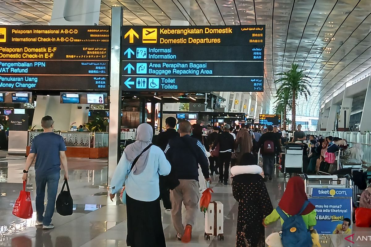
Illustration - Prospective air passengers at the departure area of Terminal 3 at Soekarno-Hatta International Airport in Tangerang, Banten. (ANTARA/Azmi Samsul M)

Tangerang, Banten (ANTARA) - Flights between Jakarta’s Soekarno-Hatta International Airport and Kualanamu International Airport in North Sumatra were disrupted after Mount Sinabung erupted, prompting cancellations and delays, PT Angkasa Pura Indonesia said here Wednesday.

Soekarno-Hatta Airport authorities continue coordinating with airlines and other stakeholders to monitor flight conditions and anticipate disruptions, Yudistiawan, the airport’s Assistant Deputy for Communications and Legal Affairs, said.

Kualanamu is currently closed because of volcanic activity, potentially causing flights to and from the airport to be delayed, canceled or diverted.

“The eruption has affected flights to and from Kualanamu, including services from Soekarno-Hatta. We continue coordinating to monitor flight conditions and passenger services,” Yudistiawan said.

On Tuesday, September 1, there were 41 flights between Soekarno-Hatta and Kualanamu, comprising 20 arrivals and 21 departures, with an estimated 5,350 passengers.

Of those flights, 15 services between Soekarno-Hatta and Kualanamu were canceled because of force majeure caused by Sinabung’s volcanic activity.

Another 14 flights were delayed, he said.

Airport authorities, airlines and other stakeholders continue monitoring Sinabung and its impact on flight operations.

“Coordination and precautionary measures are continuing to ensure flight operations and passenger services run as smoothly as possible,” Yudistiawan said.

Passengers traveling to or from Kualanamu should monitor the latest flight information and schedule changes provided by their respective airlines, the airport authority said.

“We urge passengers to regularly check flight information through their airlines. We will continue providing services and taking preventive measures as conditions evolve,” Yudistiawan said.


14306710698262293-422025.jpg


14306711131069589-422031.jpg


14306711131069589-422033.jpg


Gunung Sinabung meletus lagi, lebih 600 penduduk dipindahkan di Sumatera Utara

Utusan Sarawak
September 2, 2026

JAKARTA: Gunung Sinabung di wilayah Sumatera Utara, Indonesia meletus lagi pada pagi Rabu ketika lebih 600 penduduk dipindahkan susulan peningkatan aktiviti gunung berapi.

Menurut Pusat Vulkanologi dan Mitigasi Bencana Geologi (PVMBG), letusan bermula pada 7.20 pagi waktu tempatan dengan lajur abu menjulang kira-kira 1,000 meter dari puncak atau kira-kira 3,460 meter dari aras laut.

“Lajur abu dilihat berwarna kelabu hingga perang, tebal dan bergerak ke arah timur serta tenggara. Ketika laporan ini disediakan, letusan masih berlaku,” menurut laporan itu.

Tahap aktiviti Sinabung dinaikkan daripada Tahap II (Waspada) kepada Tahap III (Siaga) pada 12.30 tengah hari Isnin selepas pemantauan visual dan menggunakan instrumen menunjukkan peningkatan aktiviti gunung berapi.

Peningkatan tahap amaran itu dibuat susulan letusan pada awal hari berkenaan yang memuntahkan abu kira-kira 3.5 kilometer dari puncak atau kira-kira 5.96 kilometer dari aras laut, dengan pihak berkuasa memberi amaran bahawa aktiviti gunung berapi berkemungkinan terus meningkat.

Susulan peningkatan aktiviti itu, Badan Nasional Pengurusan Bencana (BNPB) pada Rabu berkata seramai 615 penduduk daripada 211 keluarga di Kuta Tengah telah dipindahkan ke pos tindak balas kecemasan, dengan kampung berkenaan antara kawasan yang dikenal pasti berisiko berhampiran gunung berapi itu.

Pemangku Ketua Pusat Data, Informasi dan Komunikasi Kebencanaan BNPB Berton Panjaitan berkata zon bahaya diperluas berdasarkan saranan Kementerian Tenaga dan Sumber Mineral.

“Penduduk dan pengunjung tidak dibenarkan menjalankan sebarang aktiviti di kawasan kampung yang telah dikosongkan, dalam lingkungan tiga kilometer dari puncak serta sehingga enam kilometer ke arah tenggara,” kata beliau dalam satu kenyataan.

Situasi itu turut mendorong Konsulat Jeneral Malaysia di Medan pada Selasa menggesa rakyat Malaysia yang berada atau menuju ke Kabupaten Karo supaya terus berwaspada, mengelakkan kawasan sekitar Gunung Sinabung dan mematuhi arahan pihak berkuasa Indonesia. – Bernama

Artikel Utusan Sarawak
 
Back
Top
Log in Register