
hartono
Legendary Member

- Messages
- 17,047
- Joined
- Jun 26, 2012
- Messages
- 17,047
- Reaction score
- 2
- Points
- 125
UB Forest deploys thermal drone to boost forest fire mitigation
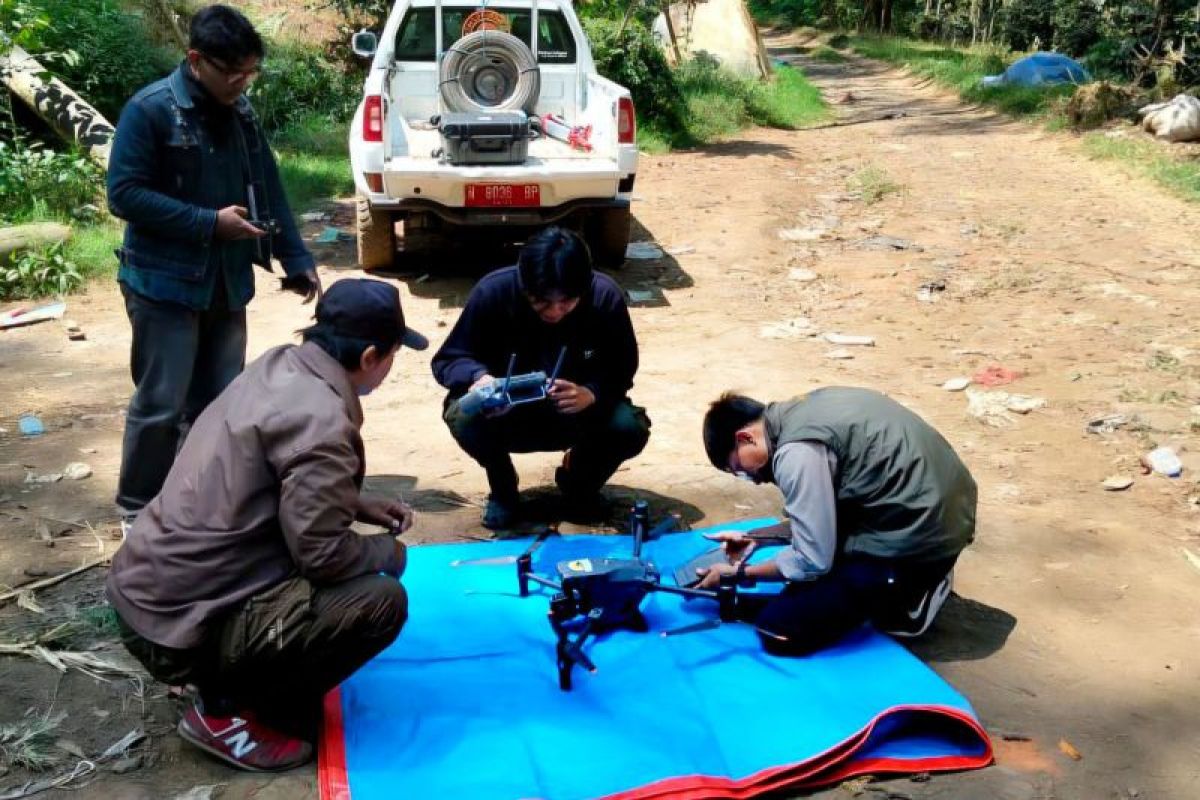
Photo archive - A team from UB Forest operating a Meatrice 30T thermal drone to monitor the forest area. The use of drones is part of strengthening forest fire mitigation efforts. ANTARA/HO-UB Forest
Malang, East Java (ANTARA) - UB Forest management is strengthening its forest fire mitigation efforts by deploying a Matrice 30T thermal drone, capable of detecting hotspots from the air around the area.
Muhammad Yusuf, the Coordinator of Forest Area Protection and Monitoring at UB Forest, said the technology assists officers in obtaining early information on suspected fires before field operations are initiated.
"If a hotspot is detected, we immediately inspect the site. Any fire found is promptly extinguished," he remarked in a statement on Thursday (September 3).
According to him, the drone is part of UB Forest management’s efforts to prepare for and prevent forest fires as the dry season intensifies.
As dry conditions persist, more intensive monitoring is needed. From August 25-27, 2026, the team used the technology to monitor the area and detected hotspots outside UB Forest, including along its border with the surrounding forest.
Yusuf said the aerial monitoring results remain a concern for officers, as the fire could spread to UB Forest if not addressed quickly.
In an effort to protect the forest area, management involves farmers working the land through a cooperation agreement (PKS).
Rifqi Rahmat Hidayatullah, Coordinator of the Functional Position Group (KJF) for Education, Training, and Development at UB Forest’s Forest Area Management UPT, said thermal drones help extend the coverage of conventional patrols and improve fire detection.
"On-foot or motorcycle patrols have limited range," he said.
Furthermore, he explained that the Matrice 30T thermal drone is equipped with sensors capable of detecting surface temperature.
If a higher-than-normal temperature is detected, officers can direct the drone to the location for closer inspection using its zoom camera.
Meanwhile, the Technical Officer at the UB Forest Education Laboratory (PLP), Yulianto Muji Nugroho, explained that the drone can monitor an area of approximately 10 hectares in one flight, with a maximum monitoring distance of approximately 500 meters.
"This thermal drone is helpful for detection, but its flight time is limited to around 30 minutes. Longer patrols require additional batteries and patrols twice a week," he noted.
According to him, the limitations make the drone a supporting tool for early detection rather than a replacement for field patrols.
UB Forest is a 544.74-hectare educational forest managed by Universitas Brawijaya (Brawijaya University) on the slopes of Mount Arjuno, East Java. Designated in 2015, the area comprises production and protected forests and serves as a site for multidisciplinary education, research, and community activities.
UB Forest deploys thermal drone to boost forest fire mitigation
UB Forest management is strengthening its forest fire mitigation efforts by deploying a Matrice 30T thermal drone, capable of detecting hotspots from the air ...
 en.antaranews.com


